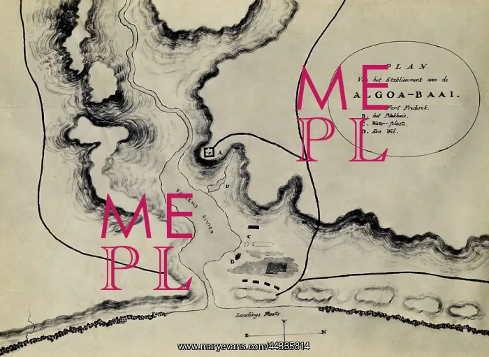
Algoa Bay: plan of the Bakens River Mouth area
Algoa Bay: plan of the Bakens River Mouth area. Map of Algoa Bay with the following inscription: Plan van het Etablisement aan de Algoa-Baai. A. het Fort Frederik. B. het Blokhuis. C. Water-plaats. D. Een Wel
Picture No
10641968
Media ID
44335814
Size
2802px x 2046px
(1.3MB)
Credit
©Africa Media Online / Mary Evans
Source
Cory Library
Pick your License
Restrictions Only for Ireland and United Kingdom
Algoa Blueprints Draft Frederik
Features In These Collections
> Contributors > AMO