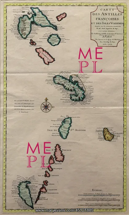
Map of the French Antilles, Musee d'Aquitaine
Map of the French Antilles, based on documents of Mr Petit, Engineer to the King, and observations of Guillaume De Pifle of the Academy of Sciences and First Geographer to the King, July 1717, in the Musee d'Aquitaine, Cours Pasteur, Bordeaux, Aquitaine, France. Picture by Manuel Cohen
Picture No
13432318
Media ID
45121885
Size
3543px x 5915px
(8.0MB)
Credit
Manuel Cohen / Mary Evans
Source
Photograph by Manuel Cohen
Pick your License
Restrictions Only for Ireland and United Kingdom and United States Of America
Antilles Aquitaine Bordeaux Daquitaine Francaises Gironde Guillaume Petit
Features In These Collections
> Contributors > COH