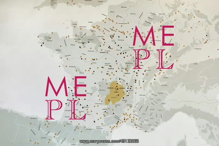
Map, Musee Archeologique de la Bataille de Gergovie
Map showing Celtic villages, 3rd - 1st centuries BC, in the permanent exhibition of the Musee Archeologique de la Bataille de Gergovie, or Archaeological Museum of the Battle of Gergovia, designed by Jean Paul Reuillard, built 2015-19 and opened 19th October 2019, on the Plateau de Gergovie, or Gergovia Plateau, site of the Battle of Gergovia between Vercingetorix, Gaulish Arverni chieftain, and Julius Caesar in 52 BC, which the Gauls won, in the Massif Central, Auvergne, France. At this time the Celtic world consisted of groups of peoples with their own names and territories. Settlements were originally not fortified and craft/artisan based. Oppidums then developed, which were defensive and grew at a time of economic development. Picture by Manuel Cohen
Pick your License
Restrictions Only for Ireland and United Kingdom and United States Of America
2015-19 2019 Archeologique Arverni Auvergne Auvergne-rhone-alpes Bataille Centuries Clermont-ferrand Excavated Excavations Gallic Gaul Gaulish Gergovia Gergovie Inrap Massif Merdogne Oppidum Plateau Rhone-alpes-auvergne Roche-blanche Vercingetorix
Features In These Collections
> Contributors > COH