
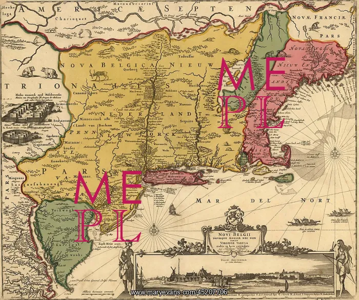
17th century map of land that became New ?
17th century map of land that became New England, New Jersey, and New York. Map includes a view of New Amsterdam, later New York City, in 1685, when it was under Dutch control. On left is an Iroquois settlement with longhouses
Picture No
10658099
Media ID
45207706
Size
2550px x 2135px
(2.1MB)
Credit
Mary Evans / Everett Collection
Usage Restrictions
Strictly editorial use only. Please contact Mary Evans if any other use required
Pick your License
Restrictions Only for Ireland and United Kingdom
Bslo Colonies Gallows Includes Iroquois Longhouse Longhouses Settlements Windmill
Features In These Collections
> Contributors > EVR












