
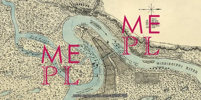
Civil War map and plan of the canal, fortifications
Civil War map and plan of the canal, fortifications and Union gunboats in the Mississippi during the Siege of Vicksburg, 1863. The canal was dug across the base of De Soto Point, to create a new channel for Union gunboats and transports to bypass the Confederate batteries at Vicksburg
Picture No
13123106
Media ID
45382780
Size
3000px x 1500px
(2.0MB)
Credit
Mary Evans / The Everett Collection
Source
Courtesy Everett Collection
Pick your License
Restrictions Only for Ireland and United Kingdom
Bypass Digging Failure Fortifications Lcgr1807 Lcgr2018 Mississippi Vicksburg
Features In These Collections
> Contributors > EVR












