
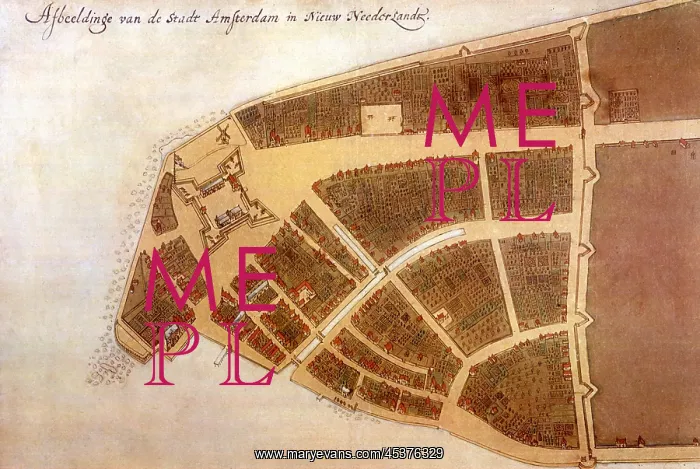
IMAGE OF THE CITY OF NEW AMSTERDAM IN NEW
IMAGE OF THE CITY OF NEW AMSTERDAM IN NEW NETHERLAND, 1660. This is the Castello Plan, the earliest known map of what is present-day Manhattan south of Wall Street (at right). The canal was a small creek deepened during Pieter Stuyvesants directorship (1646-1664) into a canal. At left, on the southern tip of Manhattan is Fort Amsterdam
Picture No
13125865
Media ID
45376329
Size
2400px x 1609px
(1.1MB)
Credit
Mary Evans / The Everett Collection
Source
Courtesy Everett Collection












