
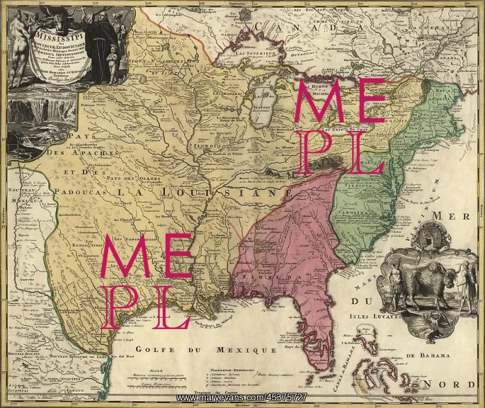
Map of central and eastern North America representing
Map of central and eastern North America representing the New France before the French and Indian War (1755-63): French (yellow), Spanish (pink) and English (Green). Explorers Joliet and Marquette, La Salle, and Louis Hennepin established Frances claim for extensive territory in central North American in the 17th century. LaSalle named it Louisiana for the King Louis XIV during his exploration of the Great Lakes region of the United States and Canada, the Mississippi River, and the Gulf of Mexico. Cartouche include Hennepins depictions of Niagara Falls and the American Bison. Map is by German Cartographer, Johann Baptist Homann, (1663-1724)
Picture No
13125799
Media ID
45375727
Size
3000px x 2522px
(3.0MB)
Credit
Mary Evans / The Everett Collection
Source
Courtesy Everett Collection












