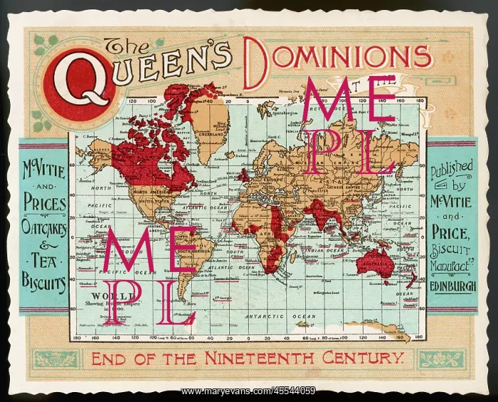
World Map Empire McVitie
A map of the world, showing the British Empire coloured in red at the end of the nineteenth century
Picture No
12004441
Media ID
45544059
Size
3873px x 3131px
(7.2MB)
Credit
Mary Evans Picture Library
Source
Advertisement for McVitie's Biscuits and Oatcakes
Date
late 19th century