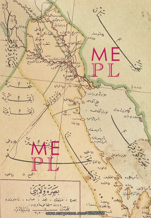
Ottoman Turkish Map of Southern Iraq
Ottoman Turkish Map of the southern province of Iraq and the territory which is now Kuwait, The area depicted focusses on Basra and the Shatt al-Arab region leading out into the Persian Gulf (lower right hand section of the map)
Picture No
10423435
Media ID
46556688
Size
3555px x 5128px
(6.2MB)
Credit
Mary Evans / Grenville Collins Postcard Collection
Source
Unattributed postcard
Date
circa 1907
Pick your License
Basra Gulf Iran Iraq Kuwait Mesopotamia Persia Shatt
Features In These Collections
> Contributors > GRC