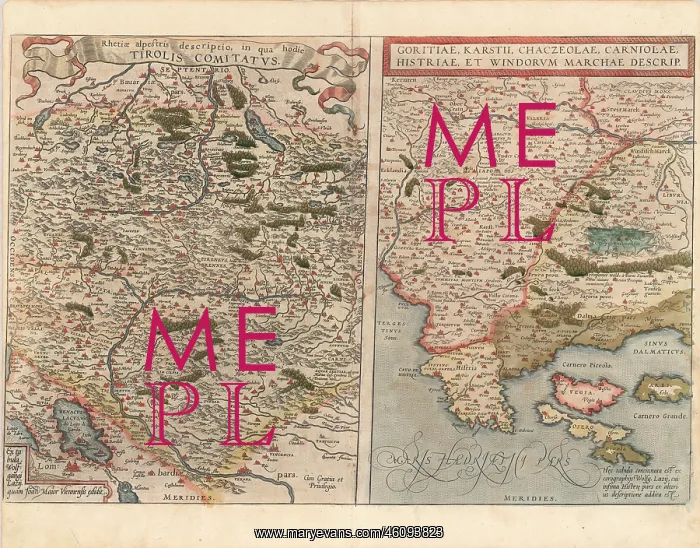
Rhetiae alpestris descriptio in qua
Rhetiae alpestris descriptio; in qua hodie Tirolis Comitatus. - Goritiae; Karstii; Chaczeolae; Carniolae; Histriae et Windorum Marchae Descrip. The Tirolian map extends from Mantua; Verona and Vincenza to Furstenfeld; Mildorf and Wasserburg and is centered on Innsburck. Salzburg also appears. The second map extends from the Islands of Cigola and Osero to the Savus River. From the 1587 French edition of Ortelius Theatrum Orbis Terrarum; the first modern Atlas
Picture No
10961204
Media ID
46093823
Size
3543px x 2773px
(5.4MB)
Credit
Mary Evans/brandstaetter images
Source
Coloured Lithograph - Abraham Ortelius