Statistics on forest areas in Russia
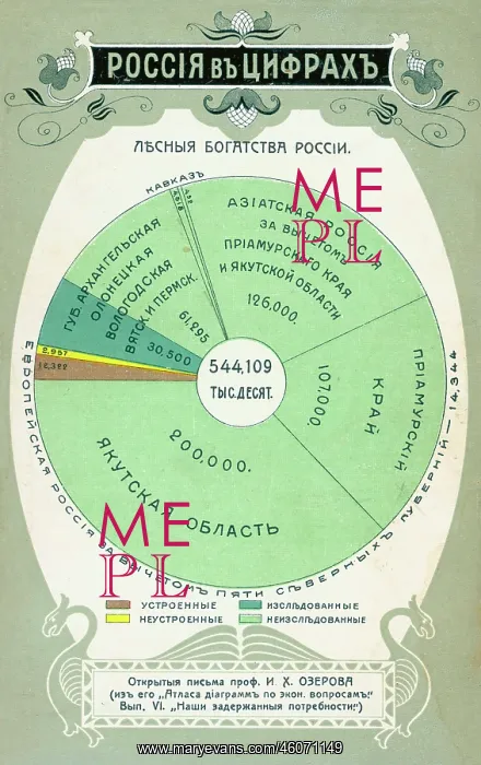
Statistics in the form of a pie chart, showing forest coverage in Russia, based on an economic atlas published by Professor I Kh Ozerov. The chart is divided up into different geographical areas of Russia, including European and Asian Russia, Arkhangelsk, Yakutsk, Vologodsk and Yakutsk. The dark green section represents unexplored areas, while the lighter green represents the explored areas
Picture No
10289784
Media ID
46071149
Size
2956px x 4697px
(2.0MB)
Credit
Mary Evans / John Massey Stewart Collection
Source
Russian postcard, Moscow
Date
early 20th century
Pick your License
Arkhangelsk Atlas Coverage Divided Explored Forestry Lighter Ozerov Statistics Unexplored Yakutsk
Features In These Collections
> Contributors > JMS