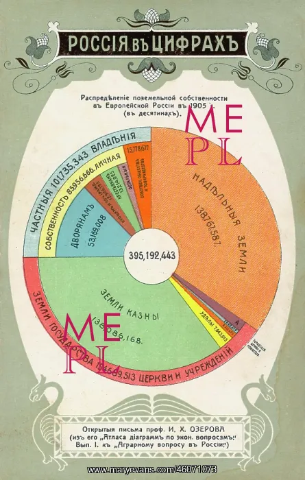
Statistics on land ownership in Russia
Statistics in the form of a pie chart, showing ownership of land in 1905, based on an economic atlas published by Professor I Kh Ozerov. The thin bright pink strip represents church and state, the thin pale blue strip represents private individuals, the darker blue sector represents the aristocracy, and the thin brown sector represents merchants
Picture No
10289773
Media ID
46071073
Size
3182px x 5008px
(2.6MB)
Credit
Mary Evans / John Massey Stewart Collection
Source
Russian postcard, Moscow
Date
1905
Pick your License
Atlas Economics Individuals Merchants Ownership Ozerov Statistics Status
Features In These Collections
> Contributors > JMS