
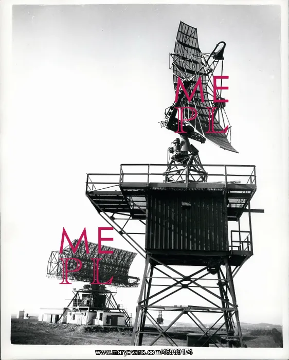
New coordinated air traffic control system, County Down
Mar. 03, 1961 - Demonstration Of New Coordinated Air Traffic Control System at County Down: A demonstration was held yesterday at Bishop's Court, County Down of the Air Traffic Control Radar Unit - which is one of a number of centres under Joint Air Ministry - Ministry of Aviation control and provides control service to military and civil aircraft in the Upper Air Space (above 25, 000 ft). The radar unit, sited at Killard Point, near Bishop's Court includes plan-position and height finding radar equipment, and military and civil ground/air radio channels with landline communication linking it with operationally associated Air Traffic Control Units in Northern Ireland, Scotland and Northern England. Photo Shows:- One of the five height-finding radar aerials Type FPS. In background is the main radar aerial Type 80 - which has a range of 180 miles covering Northern Ireland - parts of Scotland - Northern England and North Atlantic approaches to the UK
Pick your License
Restrictions Only for United Kingdom
Aerials Approaches Centres Channels Coordinated Finding Includes Joint Landline Linking Provides Radar Sited
Features In These Collections
> Contributors > KEY


