
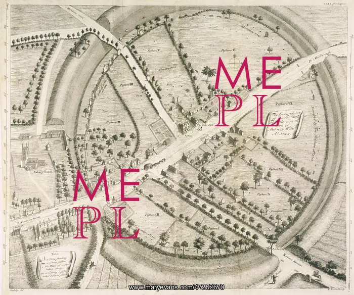
Avebury - William Stukeley Map
A beautifully drawn overhead plan of the stone circles and embankment ditches at Avebury. Stukeley's accuracy is impressive, charting every stone, pasture and building
Picture No
10063916
Media ID
47252670
Size
3493px x 2916px
(2.0MB)
Credit
Mary Evans Picture Library
Source
Engraved by Kirkall after Stukeley from Avebury, A Temple of the British Druids' by W.Stukeley (frontispiece)
Date
1743
Pick your License
1743 Accuracy Avebury Beautifully Charting Circles Ditches Earthworks Embankment Impressive Overhead Pasture Stukeley
Features In These Collections
> Contributors > MEP


