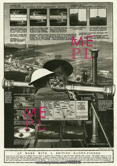
British range-finder 1918
This diagram explains the usual Britsih method of producing a range chart. It depicts an imaginary landscape behind safe lines under survey prepartory to the possible contingency of an enermy break-through. The best defensive positions have been chosen for the guns, the range of all points likely to be of use to the enemy is carefully ascertained and duly noted on the range-charts afterwards distributed to the batteries
Picture No
10697439
Media ID
47565640
Size
4284px x 6075px
(4.7MB)
Credit
Mary Evans Picture Library
Source
Drawn by S.W Clatworthy in The Graphic', 8 June 1918, page 687
Date
1918
Pick your License
Aparatus Contingency Diagram Distances Finder Lens Strategies
Features In These Collections
> Contributors > MEP