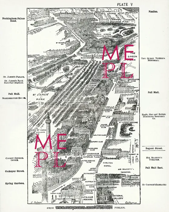
Map of the Pall Mall area of London
Map of the Charing Cross, Pall Mall and Pimlico area of central London showing, the famous thoroughfare of Pall Mall with its numerous club houses. To the left of that is a verdant Mall, before its conversion into the pink tarmac ceremonial route we know today, and St. James's Park to the left of that. Buckingham Palace can be seen at the end with Grosvenor Place behind, and Victoria train station in the distance. In the foreground is Nelson's Column in Trafalgar Square and National Gallery
Picture No
10640368
Media ID
47554051
Size
4288px x 5376px
(4.4MB)
Credit
Mary Evans Picture Library
Source
Plate V in London, 1918, originally compiled by the late Herbert Fry, 38th edition
Date
1918
Pick your License
Charing Clubland Clubs Gentlemans Mall Pall Thoroughfare
Features In These Collections
> Contributors > MEP