
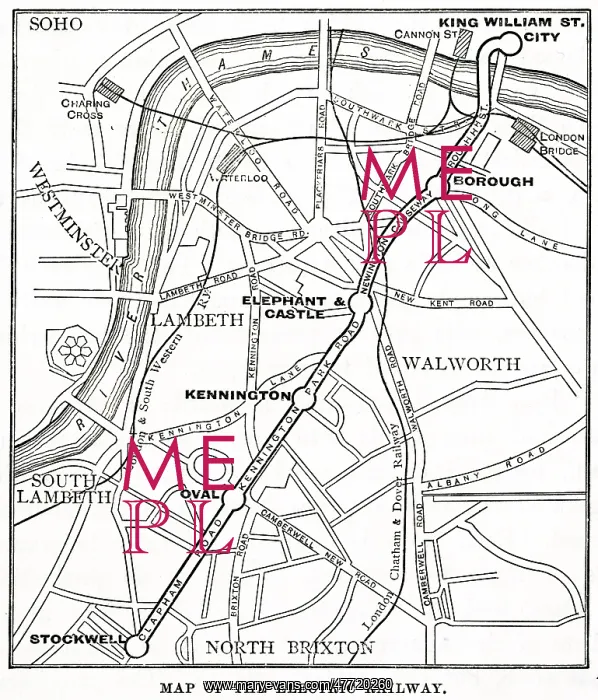
Map of underground and overground stations, South London
Map of underground and overground stations connecting the City to South London. The overground lines are the London and South Western Railway and the London Chatham and Dover Railway, serving London Bridge, Cannon Street, Waterloo and Charing Cross. The underground line was named the City Line (now part of the Northern Line), running from City (now Bank) to Stockwell, via Borough, Elephant and Castle, Kennington and Oval
Picture No
12690033
Media ID
47720260
Size
4236px x 4955px
(3.3MB)
Credit
Mary Evans Picture Library
Source
Unattributed map
Date
1894
Pick your License
Borough Brixton Charing Chatham Dover Kennington Lambeth Overground Soho Stockwell Tubes Walworth Waterloo
Features In These Collections
> Contributors > MEP


