
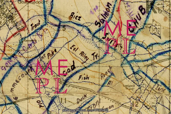
Somme Map of trenches on the battlefield during WWI
Somme Map of trenches on the battlefield during WWI showing the positions around Gommecourt and Hebuterne in France around the time of Operation Michael during the Battle of the Somme in March/April 1918.
This section shows trenches which have been given the names of fish such as Salmon Trench, Chub, Eel Alley and Trout.
The map was annotated by soldiers in the trenches at the time. The map found its way back home from the battlefield and still today displays a spattering of trench mud in places, fortunately not compromising the incredible and fascinating detail of this important resource, with hand drawn annotations adding to its intrique.
The map is dated February 1917 and that is around the time the Germans pulled out of the area shown to consolidate on the Hindenberg Line.
Research advisors at the Staffordshire Regimental Museum believe it was then it was annotated in April 1918 with the new German positions after Operation Michael, the German offensive that started on March 21st 1918, and British Forces, particularly the 5th Army were forced to retreat. One of the research advisors added that his grandfather was wounded and captured that day close to Albert.
Rossignol Wood illustrated on the map is believed to be the real location of Copse 123 in the book written by the German author Ernst Junger in June 1918, he had been a storm trooper in the offensive



























