
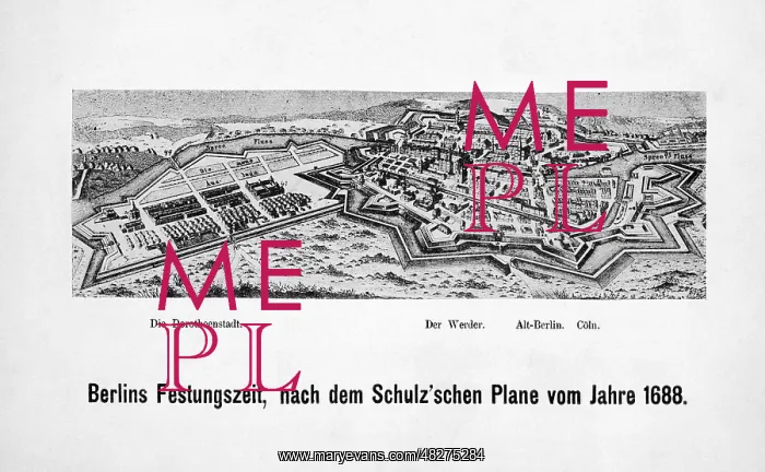
City view of Berlin, 1688
This old city map by Johann Bernhard Schultz shows Berlin in 1688 with its fortifications. On the left is the extension of the city by the Dorotheenstadt, on the right the old districts Friedrichswerder, Alt-Berlin and Coln (Alt-Kolln)
Picture No
13536486
Media ID
48275284
Size
4961px x 3058px
(2.0MB)
Credit
© Mary Evans / Sueddeutsche Zeitung Photo
Usage Restrictions
Editorial Use Only - No model release, no property release. No commercial, merchandising or advertising use without release by SZ Photo
Source
SZ Photo - Scherl
Date
1688
Pick your License
Restrictions Only for Canada and Curacao and United Kingdom and United States Of America
1688 Alt-berlin Alt-kolln Bastion Bastions Bernhard Coln Districts Dorotheenstadt Extension Fortifications Friedrichswerder Moat Overview Schultz Spree
Features In These Collections
> Contributors > SDZ


