
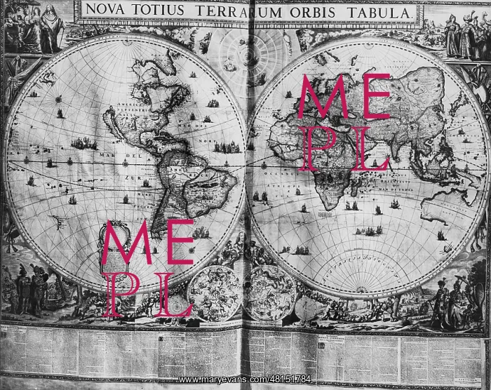


 : Elector's map, 1661


Elector's map, 1661

Elector's map from the Baroque world atlas that Johann Moritz VII of Nassau gave as a gift to the Great Elector Friedrich Wilhelm. It is the work of Frederik de Wit. The original map is on a sheet measuring 190 x 124 cm and it shows the Dutch empire, which reached its high point in the 17th century. The concept of the world became complete by the discovery of the southern seas and Australia (1644). The northwest part of North America was still unknown

Picture No
10523111
Media ID
48151784
Size
2136px x 1697px (1.6MB)
Credit
Mary Evans / SZ Photo / Scherl

Pick your License

Please tell us the book title or ISBN

Please supply intended use


Restrictions Only for Canada and Curacao and United Kingdom and United States Of America

1644 Atlas Elector Electors Frederik Measuring Moritz Nassau Northwest Reached


Features In These Collections

> Contributors > SDZ


© Copyright Mary Evans Picture Library - All Rights Reserved 2026
Powered by Media Storehouse®
We accept all major payment options so you can pay for the things you need in the way that is most convenient for you
Facebook     Twitter     Instagram