
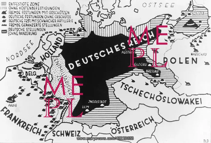
Illustration of the military vulnerability of Germany, 1
A map of the German Empire and its neighbors, which was supposed to show how vulnerable Germany was against external attacks. While other states, particularly France, were able to fall back to a wide belt of fortresses, Germany was partly demilitarized, partly without any fortifications. The image was published in 1936, to point out past grievances, which were remediated by the Nazis. Note also the indicated borders before the Versailles Treaty (including West Prussia, Pomerania, Silesia, Alsace-Lorraine). Date created: 01.01.1936-31.12.1936
Pick your License
Restrictions Only for Canada and Curacao and United Kingdom and United States Of America
Able Alsace Armament Attacks Borders Claim Conscription Demilitarization Demilitarized Fortifications Fortresses Grievances Indicated Lorraine Maginot Neighbors Particularly Partly Pomerania Refoundation Rhineland Silesia Supposed Territorial Vulnerable
Features In These Collections
> Contributors > SDZ


