
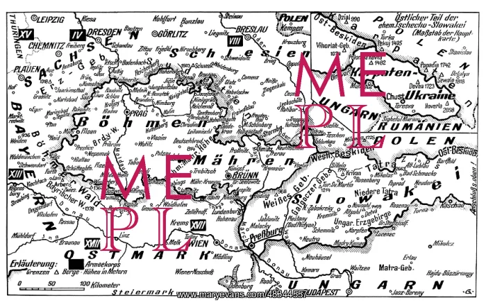
Map of the German-Czech border area, 1938
A map of the German-Czechoslovakian border area. The black rectangles with Roman numerals represent the army corps
Picture No
13323369
Media ID
48344557
Size
4957px x 3105px
(1.5MB)
Credit
(c) Mary Evans / Sueddeutsche Zeitung Photo
Usage Restrictions
No model release, no property release. No commercial, merchandising or advertising use without release by SZ Photo
Source
SZ Photo - Scherl
Date
1938
Pick your License
Restrictions Only for Canada and Curacao and United Kingdom and United States Of America
Csfr Cssr German-czech Numerals Rectangles Represent Slovakia Sudeten Sudetenland
Features In These Collections
> Contributors > SDZ


