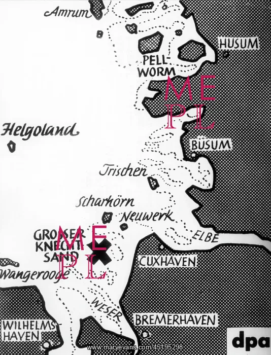
Map shows location of Knechtsand
The map shows the location of Knechtsand near the North Sea coast of Cuxhaven on 28th November 1951. The sandbank, breeding place of hundreds of thousands of different seabirds, was used by the British army as a military exercise area for several years in exchange for Helgoland
Picture No
10647569
Media ID
45195298
Size
4083px x 5346px
(2.6MB)
Credit
Mary Evans / picture-alliance / dpa
Date
28-Nov-51