
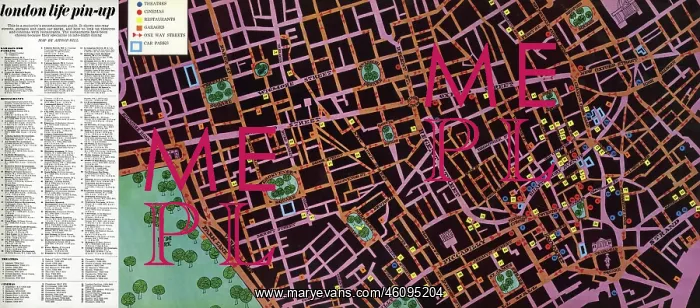
Map to the nightlife of London, 1965
A handdrawn pullout map of Soho, Leicester Square and the West End as far as Hyde Park, showing theatres, cinemas and restaurants in Central London. Intended as a motorist's entertainment guide, the map also features garages, one-way streets and car parks. The restaurants were chosen because they specialised in late-night dining
Picture No
11059897
Media ID
46095204
Size
8277px x 3641px
(18.1MB)
Credit
© Illustrated London News Ltd/Mary Evans
Source
Hand-drawn map in London Life, 9/15 October 1966, p15
Date
1966
Pick your License
Cinemas Congestion Garages Jan16 Motorist Motorists Parking Restaurants Soho Theatres
Features In These Collections
> Contributors > ILN





























