
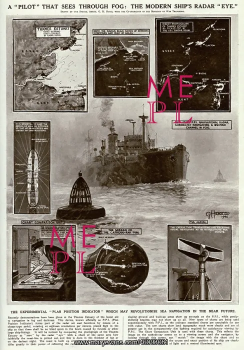
The Plan Position Indicator System by G. H. Davis
A diagram showing the system developed as part of British radar sets, first demonstrated in the Thames Estuary. The system gives a picture of obstructions in the vicinity, allowing movement in low-visibility conditions
Picture No
10638358
Media ID
46093081
Size
4151px x 5948px
(4.0MB)
Credit
© Illustrated London News Ltd/Mary Evans
Source
Illustration by G. H. Davis in The Illustrated London News', 13 April 1946
Date
1946





























