
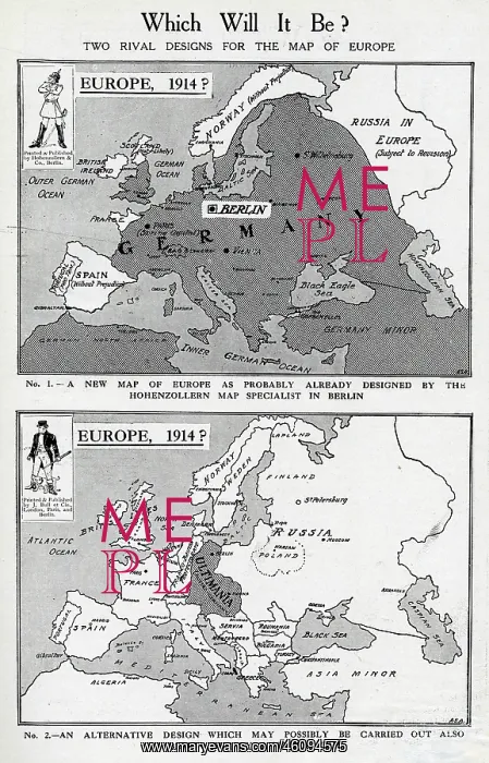
Two rival designs for the Map of Europe, WW1
Two rival designs for the Map of Europe at the start of the First World War. Above: a new map as probably already designed by the Hohenzollern map specialist in Berlin, in which Germany has a vastly expanded territory. Below: an alternative design in which Russia is expanded westwards and a small German region named Ultimania is left
Picture No
10640438
Media ID
46094575
Size
3674px x 5735px
(4.4MB)
Credit
© Illustrated London News Ltd/Mary Evans
Source
Maps by ASA in The Bystander, 26 August 1914, p447
Date
August 1914





























