
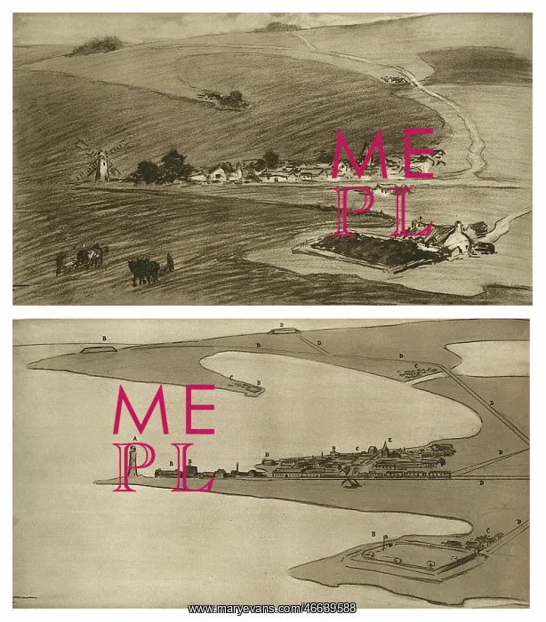
World War I spy drawing
What appears to be an innocent landscape drawing is in fact a plan of a harbour and its forts. The sketch has been made in accordance with a secret pictorial code known to the government in whose interest they were spying. In this code a windmill for example, would represent a lighthouse; a plantation of trees, a fort; a single farmhouse or cottage, a group of buildings; a group of houses, a town; a church, Admiralty offices or a Town Hall and double lines (ostensibly roads), railway tracks. In the image below, the innocent landscape has been decoded by the enemy for whom the drawing was made
Picture No
10956661
Media ID
46639588
Size
5862px x 6675px
(6.0MB)
Credit
© Illustrated London News Ltd/Mary Evans
Source
Unattributed illustration in The Illustrated War News, 7th October 1914, page 28
Date
1914





























