
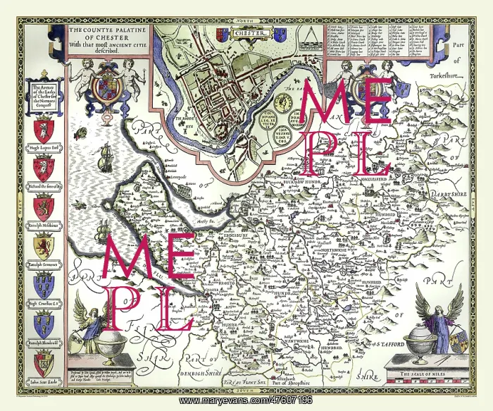
17th Century map of the County of Cheshire, England
John Speed's County of Cheshire 1610 has a plan of the city of Chester prominently set in the centre top of the map It has a list of thirty one place names and is flanked on either side by coats of arms within decorative borders supported by cherubs. The heraldic arms of the Earls of Chester are shown down the left side of the map and there are two other vignettes of angels in the bottom corners. A lovely map for your collection
Picture No
10825417
Media ID
47607196
Size
9000px x 7500px
(34.2MB)
Credit
Mary Evans Picture Library/Mapseeker Publishing
Source
Originally Published by John Speed, digitally re-mastered from an antique original by Mapseeker Publishing
Date
1611



























