
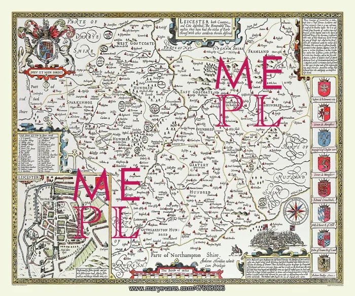
17th Century map of the County of Leicestershire, England
This county map of Leicestershire 1611 by John Speed is a very interesting historical document. It has a town plan of Leicester, the county town. It was also famous as being the burial ground for Cardinal Wolsey and for Richard III, who was killed at Bosworth, which is marked as King Richard's Field on this map. There is a text relating to the Saxon and Norman noblemen that inhabited the area and the coats of arms of later Earls also a vignette of the battle of Bosworth fought in 1485
Picture No
10825434
Media ID
47608006
Size
9000px x 7500px
(44.8MB)
Credit
Mary Evans Picture Library/Mapseeker Publishing
Source
Originally Published by John Speed, digitally re-mastered from an antique original by Mapseeker Publishing
Date
1611



























