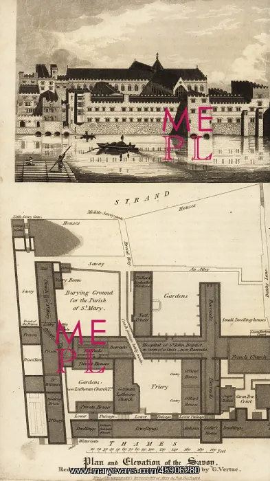
Plan and elevation of the Savoy buildings, London, 1736
Plan and elevation of the Savoy, between the Strand and the Thames River, from a view taken in the year 1736 by George Vertue. Floorplan shows barracks, hospital, houses, gardens, burying ground, French church, German Lutheran church and dwellings. Copperplate engraving from Rudolph Ackermann's Repository of Arts, London, 1816
Picture No
13135573
Media ID
45906280
Size
4072px x 7255px
(8.5MB)
Credit
Florilegius
Source
George Vertue