
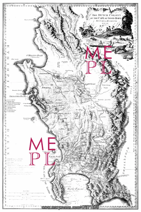
Africa, Cape of Good Hope, 1795
L.S. de la Rochette's map of the Cape of Good Hope. During the Napoleonic Wars, the Dutch Republic was occupied by the French in 1795. Thus the Cape Colony became a French vassal and enemy of the British. Therefore, the United Kingdom invaded and occupied the Cape Colony that same year. No biographical information can be found for Rochette. From William Faden's General Atlas, 1795. William Faden (1749 - 1836) was an English cartographer and a publisher of maps. He was the royal geographer to King George III
Picture No
12696183
Media ID
47671670
Size
3043px x 4575px
(2.6MB)
Credit
Science Source/Mary Evans
Pick your License
Restrictions Only for Ireland and United Kingdom
1700s 1790s 1795 Cartographic Cartographical Eighteenth Map-making Mapmaking
Features In These Collections
> Contributors > PHR





























