
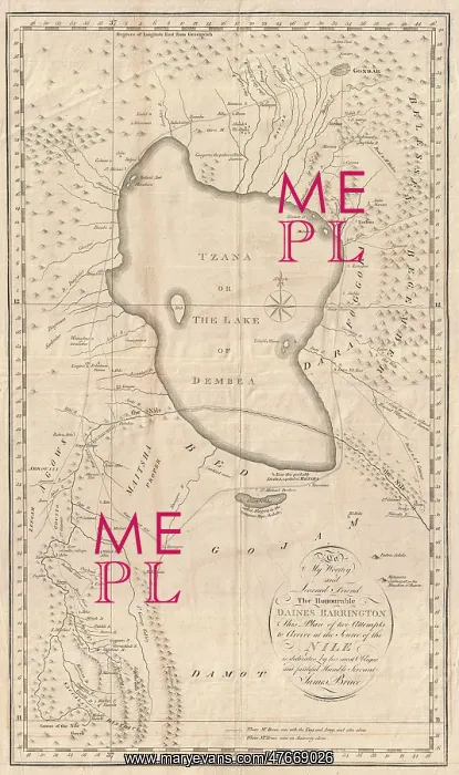
James Bruce, Sources of the Nile Map, 1790
Detailed 1790 map of Ethiopia (Abyssinia) and the source of the Blue Nile by James Bruce. Centered on Lake Tana (Tzana), this map covers from the Ethiopian capital at Gondar south as far as the Saccala District and the Geesh Abay (Geesh Springs). The map plots Bruce's travels in search of the source of the Blue Nile starting from the Ethiopian capital of Gondar. Local guides led Bruce southwards around Lake Tana (Tzana) and eventually down the Abay River to Gish Abay, the source of the Blue Nile. Bruce claimed to have discovered the Gish Abay springs, but in a fact that he was well aware of, was merely retracing the steps of the Jesuit missionaries Pedro Paez and JerCunimo Lobo
Pick your License
Restrictions Only for Ireland and United Kingdom
1700s 1790 Abyssinia Cartographic Cartographical Eighteenth Ethiopia Ethiopian Gish Gondar Kinnaird Source Sources Tana
Features In These Collections
> Contributors > PHR





























