
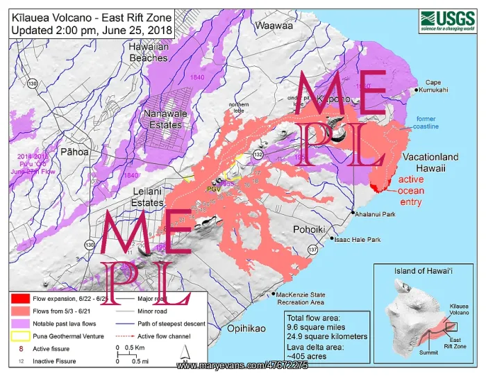
Kilauea Eruption, June 2018
Map showing the fissures and lava flows from Kzelauea's lower East Rift Zone eruption, as of 2:00 p.m. HST, June 25, 2018. Shaded purple areas indicate lava flows erupted in 1840, 1955, 1960, and 2014-2015. The 2018 lava flows are in pink, and the red areas along the coast are active ocean entry areas. Compare with the map from May 8 (SS21449782), showing the former coastline and Kapoho Bay, near Vacationland
Picture No
12696254
Media ID
47672275
Size
3300px x 2550px
(2.3MB)
Credit
U.S. Geological Survey/Science Source/Mary Evans
Pick your License
Restrictions Only for Ireland and United Kingdom
Changed Compare Compared Compares Comparing Comparison Delta Diagram Eruption Estates Fissure Flow Geologic Geological Geologically Geoscience Hawaiian Kilauea Lava Leilani Rift Usgs Vacationland Volcanic Volcanism Volcano Volcanology Vulcanology
Features In These Collections
> Contributors > PHR





























