
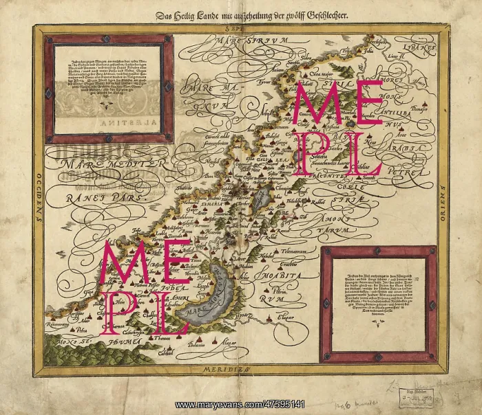
Map of Palestine, 1588
16th century map of Palestine. North is towards upper right. Published in 1588, this German map shows the geography of Palestine, centerd on the area that later become the state of Israel. The inscriptions are in German, and the place names are in Latin. These include ancient names like Petra, Coele Syria and Judea. The Dead Sea is at lower center, and the Mediterranean coast is at left. Numerous towns and villages are shown on the map. The map is by the German cartographer Sebastian Munster (1489-1552), and was published in Basel in a posthumous edition of his Cosmographia, the earliest German atlas
Picture No
10798725
Media ID
47595141
Size
4967px x 4289px
(7.0MB)
Credit
©Photo Researchers / Mary Evans Picture Library
Source
Photo Researchers
Pick your License
Restrictions Only for Ireland and United Kingdom
1500s 1588 Cosmographia Judea Munster Petra
Features In These Collections
> Contributors > PHR





























