
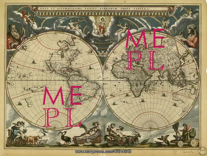
World Map, 17th Century
World map, published around 1664 in Amsterdam, the Netherlands, by Dutch mapmaker Joan Blaeu (c.1599-1673). The Latin title is Nova et Accuratissima Totius Terrarum Orbis Tabula (new and accurate all world map). Blaeu's maps built on those made by Mercator and Hondius in the late 16th and early 17th centuries. The Blaeu maps emphasized fine art and colors, being the most expensive of the time. Two mapmakers are shown at upper right and upper left, together with a wide variety of mythical beings. The poorly-mapped regions include the far north and south, parts of the Americas (left-hand hemisphere), and the Far East. The western coast of Australia (New Holland) was discovered in 1616
Pick your License
Restrictions Only for Ireland and United Kingdom
1600s 1664 Accuratissima Americas Blaeu Continent Continents Diagram Eurasia Hemisphere Hemispheres Inaccurate Incomplete Nova Orbis Tabula Terrarum Totius
Features In These Collections
> Contributors > PHR





























