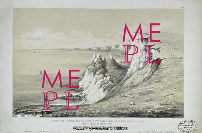


 : Landslip Under Southdown between Beer Head and Branscombe


Landslip Under Southdown between Beer Head and Branscombe

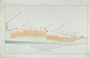
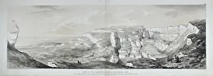
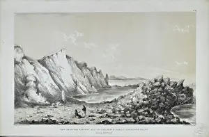
Landslip Under Southdown between Beer Head and Branscombe, which took place 1789-90 looking Westward to Sidmouth, Torbay and the Start Point, lithographed by George Scharf after drawing by William Dawson. The Axmouth-Lyme Regis stretch of the south coast of England comprises one of the best known areas of landslipping in Great Britain. It includes the site of the first large-scale landslide ever to have been the subject of detailed scientific description by geologists: the Great Bindon Landslide which happened on Christmas Day, 1839. Fortuitously William Buckland (1784-1856) and his scientific artist wife Mary nee Morland (1797-1857) were quickly on the spot as they had been visiting fellow geologist Wiliam Daniel Conybeare (1787-1857) in nearby Axminster. The three, along with Mary Anning (1799-1847), investigated the incident. Coloured lithograph

Picture No
14154662
Media ID
45863983
Size
5412px x 3558px (2.2MB)
Credit
© The Geological Society / Mary Evans
Source
Geological Society of London. W D Conybeare's and William Buckland's work Ten plates comprising a plan, sections, and views, representing the changes produced on the coast of East Devon, between Axmouth and Lyme Regis by the subsidence of the land and elevation of the bottom of the sea, on the 26th December, 1839, and 3rd of February, 1840', London: John Murray (1840), plate 10. - Image reference: 27-30
Date
1840

Pick your License

Please tell us the book title or ISBN

Please supply intended use


1784-1856 1787-1857 1797-1857 1799-1847 1839 Anning Axminster Axmouth-lyme Bindon Branscombe Buckland Comprises Conybeare Description Detailed Fellow Fortuitously Geologist Geologists Happened Incident Includes Investigated Landslide Landslip Landslipping Large-scale Lithographed Morland Nearby Quickly Regis Scharf Sidmouth Southdown Stretch Torbay Westward Wiliam


Features In These Collections

> Contributors > GSO
> The Geological Society

You May Also Like


Gallery Wall Inspiration

Portrait of Mary Anning (1799-1847)
Section of a well sunk at Hampstead Road Reservoir
Submarine life of the Schambelen (Lower Jurassic)
Fossil fish from the collection of William Willoughby Cole
Lepidotus gigas Agassiz
Northern Bohemia during the time of lignite formation
Ideal landscape of the Eocene Period
Zurich at the Glacial Period
Lecture theatre, the New School of Mines, Sydney University
Plan of a Water-Meadow made out of part of a Bog
Acrolepis asper Agassiz
Tetragonolepis angulifer Agassiz
Flagstaff and Barnhills - Sugar-loaf in distance, St Helena
Yellowstone Lake
Summit of the Ural E of Zlatoust
Buildings on a rocky outcrop
The Western Archway of the Thames Tunnel
Proposed Gravesend to Tilbury Fort Tunnel
Flint tool found at the Freville Pit at Saint-Acheul, Amiens
Basaltic tower Castro Levit - foot of Magilligan Facade
Cape Wrath
Peculiar appearance of a rock surface
Ideal landscape of the Liassic Period
La vana speculazione disingannata dal senso
Discovery of the temple of Isis at Pompeii
Charta ofver en del af Lappska Fjallen (1807)
Ideal view of marine life in the Carboniferous Period


© Copyright Mary Evans Picture Library - All Rights Reserved 2026
Powered by Media Storehouse®
We accept all major payment options so you can pay for the things you need in the way that is most convenient for you
Facebook     Twitter     Instagram