
![: First Geological Map of Scotland [1808]](/p/800/first-geological-map-scotland-1808-48658245.jpg.webp ": First Geological Map of Scotland [1808]")
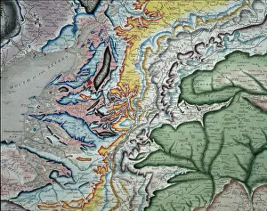
First Geological Map of Scotland [1808]
First Geological Map of Scotland [1808], by Louis Albert Necker (1786-1861). Map entitled Scotland coloured according to the rock formations'. Geological colouring on base map North Britain or Scotland divided into its Counties, corrected from the best surveys and astronomical observations by Thomas Kitchin, published by William Faden, 1 December 1778. This map, which is probably the earliest geological map of Scotland, was coloured by the Swiss mineralogist Louis Albert Necker (1786-1861) and was given to the Geological Society in 1808, only a year after our foundation in 1807. Watercolour on engraved base
Pick your License
1778 1807 1808 According Astronomical Colouring Corrected Counties Divided Earliest Entitled Faden Formations Geological Kitchin Mineralogist Necker Observations Surveys
Features In These Collections
> Contributors > GSO





















![Earliest geological map of Ireland [1814]](/sq/800/earliest-geological-map-ireland-1814-48658336.jpg.webp "Earliest geological map of Ireland [1814]")



![Draft of the first geological map of Jersey [c.1828]](/sq/800/draft-first-geological-map-jersey-c1828-48658294.jpg.webp "Draft of the first geological map of Jersey [c.1828]")
![First geological map of Jersey [c.1828]](/sq/800/first-geological-map-jersey-c1828-48658274.jpg.webp "First geological map of Jersey [c.1828]")

![First Geological Map of Scotland [1808]](/sq/800/first-geological-map-scotland-1808-48658245.jpg.webp "First Geological Map of Scotland [1808]")


