
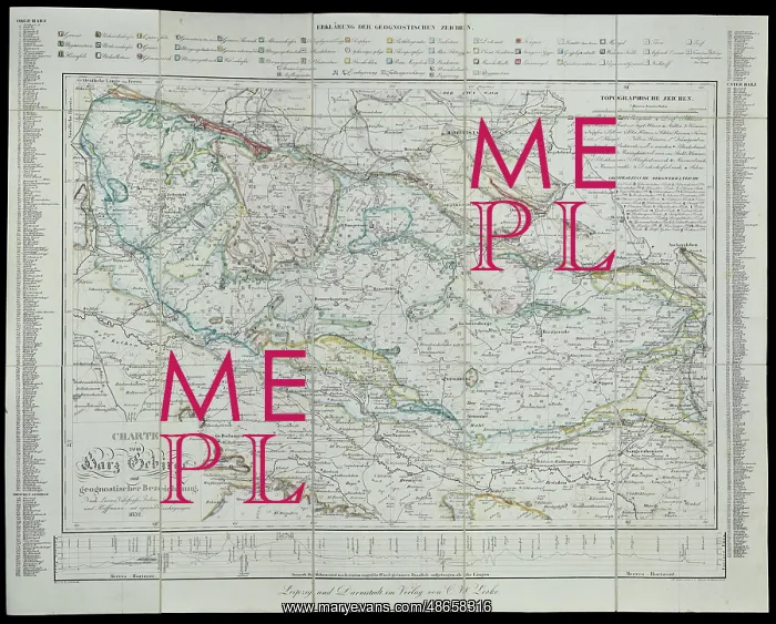
Geognostic map of the Harz Mountains (1832)
Charte vom Harz Gebirge mit geognostischer bezeichnung. Nach Lasius, Villefosse, Julius, Berghaus und Hoffmann mit eignen Berichtigungen [Geognostic map of the Harz Mountains, after Lasius, Villefosse, Julius, Berghaus and Hoffman with corrections], by Christian Zimmerman (1768-1853). This travel book to the Harz Mountains in Germany, is from the collection of George Bellas Greenough, first President of the Geological Society. Hand coloured engraving
Picture No
14160631
Media ID
48658316
Size
7335px x 5904px
(6.7MB)
Credit
© The Geological Society / Mary Evans
Source
Geological Society of London. Taken from: Zimmermann, C. Das Harzgebirge in besonderer Beziehung auf Natur- und Gewerbskunde geschildert. Ein Handbuch fur Reisende und Alle, die das Gebirge naher kennen zu lernen wunschen, mit Nachweisungen uber Naturschonheiten. In Verbindung mit Freunden unternommen'. Darmstadt: Druck und Verlag von Carl Wilhelm Leske (1834) - Image reference: 07-177
Date
1832
Pick your License
1832 Bellas Corrections Geological Greenough Harz Zimmerman
Features In These Collections
> Contributors > GSO



















![Earliest geological map of Ireland [1814]](/sq/800/earliest-geological-map-ireland-1814-48658336.jpg.webp "Earliest geological map of Ireland [1814]")



![Draft of the first geological map of Jersey [c.1828]](/sq/800/draft-first-geological-map-jersey-c1828-48658294.jpg.webp "Draft of the first geological map of Jersey [c.1828]")
![First geological map of Jersey [c.1828]](/sq/800/first-geological-map-jersey-c1828-48658274.jpg.webp "First geological map of Jersey [c.1828]")

![First Geological Map of Scotland [1808]](/sq/800/first-geological-map-scotland-1808-48658245.jpg.webp "First Geological Map of Scotland [1808]")


