
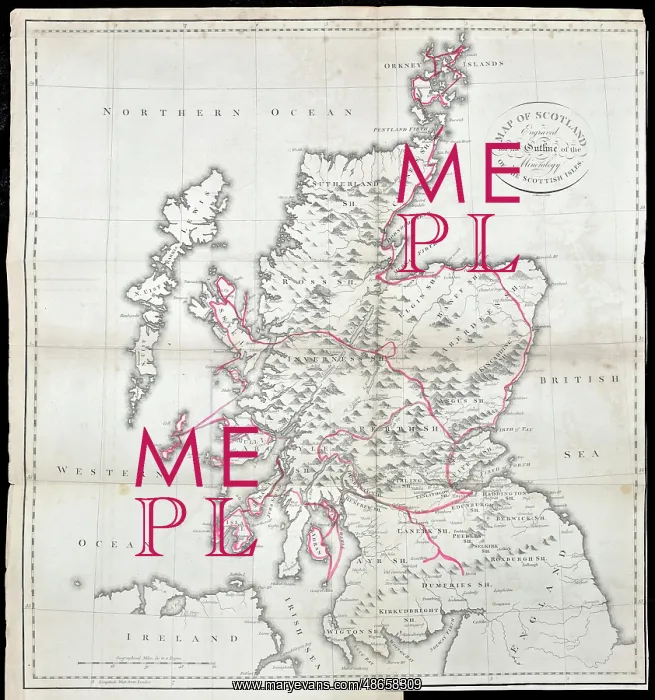
Jameson's outline map of Scotland (1800)
Map of Scotland engraved for the outline of the mineralogy of the Scottish Isles, by J Menzies for Robert Jameson (1774-1854). Map showing the route taken by the Scottish mineralogist Robert Jameson to view the major geological and mineralogical sites of Scotland. Engraving
Picture No
14160629
Media ID
48658309
Size
5721px x 6116px
(4.5MB)
Credit
© The Geological Society / Mary Evans
Source
Geological Society of London. From Robert Jameson's book Mineralogy of the Scottish Isles with mineralogical observations made in a tour through different parts of the mainland of Scotland, and dissertations upon peat and kelp', Edinburgh (1800) - Image reference: 07-175
Date
1800Â
Pick your License
Geological Isles Jameson Jamesons Menzies Mineralogical Mineralogist Outline Sites
Features In These Collections
> Contributors > GSO



















![Earliest geological map of Ireland [1814]](/sq/800/earliest-geological-map-ireland-1814-48658336.jpg.webp "Earliest geological map of Ireland [1814]")



![Draft of the first geological map of Jersey [c.1828]](/sq/800/draft-first-geological-map-jersey-c1828-48658294.jpg.webp "Draft of the first geological map of Jersey [c.1828]")
![First geological map of Jersey [c.1828]](/sq/800/first-geological-map-jersey-c1828-48658274.jpg.webp "First geological map of Jersey [c.1828]")

![First Geological Map of Scotland [1808]](/sq/800/first-geological-map-scotland-1808-48658245.jpg.webp "First Geological Map of Scotland [1808]")


