
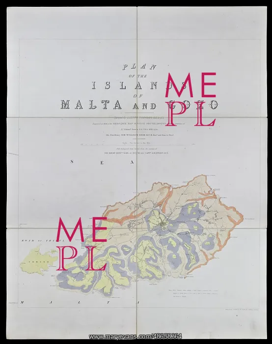
Geological map of Gozo and Cominos, Malta
Plan of the islands of Malta and Gozo by J W Worsley, using geological data from Earl of Ducie and Capt T A B Spratt, RN. Coloured lithograph
Picture No
14160635
Media ID
48658364
Size
7548px x 9544px
(5.5MB)
Credit
© The Geological Society / Mary Evans
Source
Geological Society of London - Image reference: 07-184
Date
1856
Pick your License
1856 Capt Data Ducie Geological Gozo Spratt Worsley
Features In These Collections
> Contributors > GSO





















![Earliest geological map of Ireland [1814]](/sq/800/earliest-geological-map-ireland-1814-48658336.jpg.webp "Earliest geological map of Ireland [1814]")



![Draft of the first geological map of Jersey [c.1828]](/sq/800/draft-first-geological-map-jersey-c1828-48658294.jpg.webp "Draft of the first geological map of Jersey [c.1828]")
![First geological map of Jersey [c.1828]](/sq/800/first-geological-map-jersey-c1828-48658274.jpg.webp "First geological map of Jersey [c.1828]")

![First Geological Map of Scotland [1808]](/sq/800/first-geological-map-scotland-1808-48658245.jpg.webp "First Geological Map of Scotland [1808]")


