
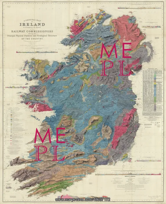
A general map of Ireland (Griffith, 1855)
A general map of Ireland to accompany the report of the Railway Commissioners shewing the principal physical features and geological structure of the country, by Sir Richard John Griffith. Revised third edition. Original printed in six separate sheets. Geological map, ink (lithograph from engraved plate) and watercolour, on paper, bound in atlas
Picture No
14160529
Media ID
48657172
Size
11811px x 14437px
(45.9MB)
Credit
© The Geological Society / Mary Evans
Source
Geological Society of London - Image reference: 07-24
Date
1855
Pick your License
Accompany Atlas Commissioners Geological Revised Separate Sheets Shewing
Features In These Collections
> Contributors > GSO



















![Earliest geological map of Ireland [1814]](/sq/800/earliest-geological-map-ireland-1814-48658336.jpg.webp "Earliest geological map of Ireland [1814]")



![Draft of the first geological map of Jersey [c.1828]](/sq/800/draft-first-geological-map-jersey-c1828-48658294.jpg.webp "Draft of the first geological map of Jersey [c.1828]")
![First geological map of Jersey [c.1828]](/sq/800/first-geological-map-jersey-c1828-48658274.jpg.webp "First geological map of Jersey [c.1828]")

![First Geological Map of Scotland [1808]](/sq/800/first-geological-map-scotland-1808-48658245.jpg.webp "First Geological Map of Scotland [1808]")


