
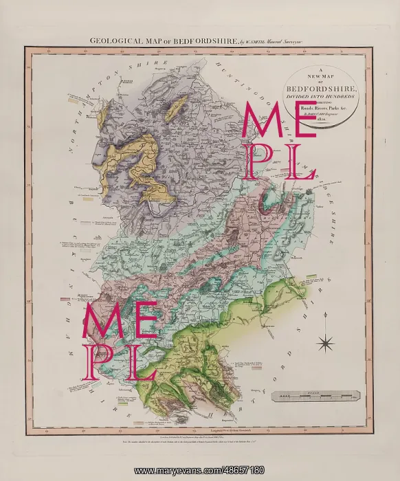
Geological Map of Bedfordshire (William Smith, 1820)
Geological map of the English county of Bedfordshire, by William Smith (1769-1839). This map was published in the third of William Smith's series of six atlases of geological maps of English counties. Geological map, ink (lithograph from engraved plate) and watercolour, on paper, bound in atlas
Picture No
14160530
Media ID
48657180
Size
5986px x 7206px
(5.1MB)
Credit
© The Geological Society / Mary Evans
Source
Geological Society of London - Image reference: 07-25
Date
1820
Pick your License
1769-1839 Atlas Atlases Bedfordshire Counties Geological
Features In These Collections
> Contributors > GSO



















![Earliest geological map of Ireland [1814]](/sq/800/earliest-geological-map-ireland-1814-48658336.jpg.webp "Earliest geological map of Ireland [1814]")



![Draft of the first geological map of Jersey [c.1828]](/sq/800/draft-first-geological-map-jersey-c1828-48658294.jpg.webp "Draft of the first geological map of Jersey [c.1828]")
![First geological map of Jersey [c.1828]](/sq/800/first-geological-map-jersey-c1828-48658274.jpg.webp "First geological map of Jersey [c.1828]")

![First Geological Map of Scotland [1808]](/sq/800/first-geological-map-scotland-1808-48658245.jpg.webp "First Geological Map of Scotland [1808]")


