
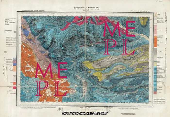
Geological map of Brough-under-Stainmore
Geological map of the village of Brough under Stainmore in Cumbria, England, and the surrounding area, at a scale of one inch to the mile, by Sir Archibald Geikie, Geological Survey of England and Wales. It corresponds to Ordnance Survey sheet 102SE. Geological map
Picture No
14160522
Media ID
48657207
Size
3420px x 2349px
(2.9MB)
Credit
© The Geological Society / Mary Evans
Source
Geological Society of London - Image reference: 07-10
Date
1893
Pick your License
Archibald Brough Corresponds Geikie Geological Inch Ordnance Surrounding Survey
Features In These Collections
> Contributors > GSO




















![Earliest geological map of Ireland [1814]](/sq/800/earliest-geological-map-ireland-1814-48658336.jpg.webp "Earliest geological map of Ireland [1814]")



![Draft of the first geological map of Jersey [c.1828]](/sq/800/draft-first-geological-map-jersey-c1828-48658294.jpg.webp "Draft of the first geological map of Jersey [c.1828]")
![First geological map of Jersey [c.1828]](/sq/800/first-geological-map-jersey-c1828-48658274.jpg.webp "First geological map of Jersey [c.1828]")

![First Geological Map of Scotland [1808]](/sq/800/first-geological-map-scotland-1808-48658245.jpg.webp "First Geological Map of Scotland [1808]")


