
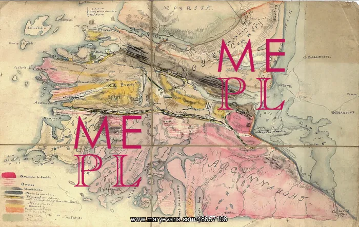
Geological Map of Connemara, Ireland (Nimmo, c.1813)
Geological map of Connemara, Ireland, by Alexander Nimmo. Connemara is an area in the west of the country, in the west part of County Galway. Clifton Village, which appears on the map was founded c. 1812. George Bellas Greenough whose writing appears on the map, visited the area with Alexander Nimmo in 1813. Manuscript, backed on cloth
Picture No
14160520
Media ID
48657198
Size
5685px x 3595px
(4.2MB)
Credit
© The Geological Society / Mary Evans
Source
Geological Society of London. Archive reference: LDGSL/947/6/F/2 - Image reference: 07-08
Date
circa 1813



















![Earliest geological map of Ireland [1814]](/sq/800/earliest-geological-map-ireland-1814-48658336.jpg.webp "Earliest geological map of Ireland [1814]")



![Draft of the first geological map of Jersey [c.1828]](/sq/800/draft-first-geological-map-jersey-c1828-48658294.jpg.webp "Draft of the first geological map of Jersey [c.1828]")
![First geological map of Jersey [c.1828]](/sq/800/first-geological-map-jersey-c1828-48658274.jpg.webp "First geological map of Jersey [c.1828]")

![First Geological Map of Scotland [1808]](/sq/800/first-geological-map-scotland-1808-48658245.jpg.webp "First Geological Map of Scotland [1808]")


