
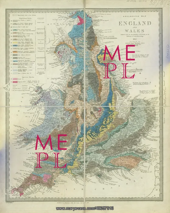
Geological map of England and Wales (Murchison, 1843)
Geological map of England and Wales published under the superintendence of the Society for the Diffusion of Useful Knowledge, by Sir Roderick Impey Murchison (1792-1871). Lithograph and watercolour on paper, dissected and mounted on linen
Picture No
14160644
Media ID
48657916
Size
5303px x 6634px
(5.6MB)
Credit
© The Geological Society / Mary Evans
Source
Geological Society of London - Image reference: 07-193
Date
1843



















![Earliest geological map of Ireland [1814]](/sq/800/earliest-geological-map-ireland-1814-48658336.jpg.webp "Earliest geological map of Ireland [1814]")



![Draft of the first geological map of Jersey [c.1828]](/sq/800/draft-first-geological-map-jersey-c1828-48658294.jpg.webp "Draft of the first geological map of Jersey [c.1828]")
![First geological map of Jersey [c.1828]](/sq/800/first-geological-map-jersey-c1828-48658274.jpg.webp "First geological map of Jersey [c.1828]")

![First Geological Map of Scotland [1808]](/sq/800/first-geological-map-scotland-1808-48658245.jpg.webp "First Geological Map of Scotland [1808]")


