
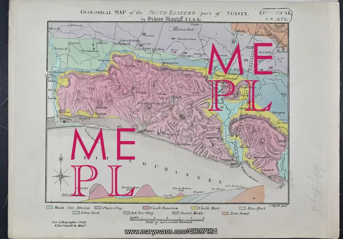
Geological Map of the South-Eastern part of Sussex
The author of this map Gideon Mantell (1790-1852) rose from relatively humble birth (the son of a shoemaker) to become one of the most influential geologists of the first half of the 19th century. His uncanny ability to uncover the fossilised remains of new species of reptiles, fish, invertebrates and plants mostly from the Sussex area earned him the nickname Wizard of the Weald'. 500 copies of this lithographed, hand coloured map were produced in December 1819. Although the map was distributed separately, it was produced to be bound within his book Fossils of the South Downs (1822)
Pick your License
1790-1852 1819 1822 Ability Although Copies Distributed Downs Earned Fossilised Fossils Geological Geologists Gideon Humble Invertebrates Lithographed Mantell Mostly Nickname Relatively Reptiles Separately Shoemaker South-eastern Uncanny Uncover Weald Wizard
Features In These Collections
> Contributors > GSO
























![Earliest geological map of Ireland [1814]](/sq/800/earliest-geological-map-ireland-1814-48658336.jpg.webp "Earliest geological map of Ireland [1814]")



![Draft of the first geological map of Jersey [c.1828]](/sq/800/draft-first-geological-map-jersey-c1828-48658294.jpg.webp "Draft of the first geological map of Jersey [c.1828]")
![First geological map of Jersey [c.1828]](/sq/800/first-geological-map-jersey-c1828-48658274.jpg.webp "First geological map of Jersey [c.1828]")

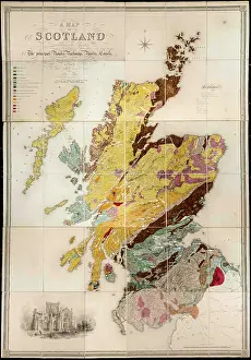
![First Geological Map of Scotland [1808]](/sq/800/first-geological-map-scotland-1808-48658245.jpg.webp "First Geological Map of Scotland [1808]")


