
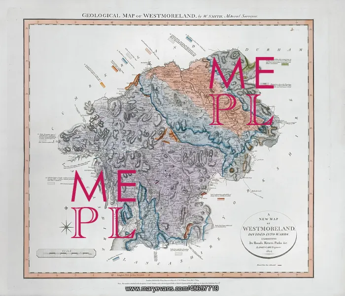
Geological Map of Westmoreland (William Smith, 1824)
Geological map of the English county of Westmorland, by William Smith (1769-1839). This map was published in the sixth of William Smith's series of six atlases of geological maps of English counties. Geological map
Picture No
14160565
Media ID
48657719
Size
7264px x 6246px
(6.0MB)
Credit
© The Geological Society / Mary Evans
Source
Geological Society of London - Image reference: 07-94
Date
1824
Pick your License
1769-1839 1824 Atlases Counties Geological Sixth Westmoreland Westmorland
Features In These Collections
> Contributors > GSO



















![Earliest geological map of Ireland [1814]](/sq/800/earliest-geological-map-ireland-1814-48658336.jpg.webp "Earliest geological map of Ireland [1814]")



![Draft of the first geological map of Jersey [c.1828]](/sq/800/draft-first-geological-map-jersey-c1828-48658294.jpg.webp "Draft of the first geological map of Jersey [c.1828]")
![First geological map of Jersey [c.1828]](/sq/800/first-geological-map-jersey-c1828-48658274.jpg.webp "First geological map of Jersey [c.1828]")

![First Geological Map of Scotland [1808]](/sq/800/first-geological-map-scotland-1808-48658245.jpg.webp "First Geological Map of Scotland [1808]")


