
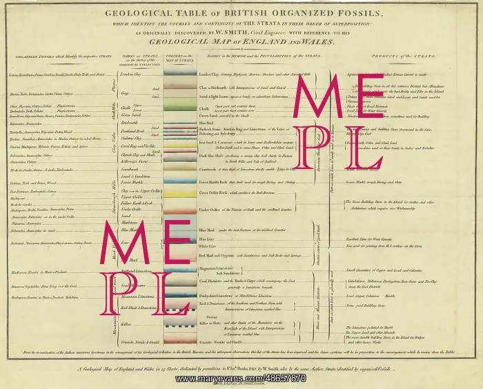
Geological table of British organized fossils
Printed table, Geological table of British organized fossils, which identify the course and continuity of the Strata in their order of superposition; as originally discovered by W Smith, Civil Engineer [William Smith (1769-1839)]; with reference to his Geological Map of England and Wales'. Sold by John Cary, 181 The Strand, London. Printed item with hand colouring
Picture No
14160589
Media ID
48657870
Size
4944px x 3984px
(3.2MB)
Credit
© The Geological Society / Mary Evans
Source
Geological Society of London. Archive reference: LDGSL/747 - Image reference: 07-128
Date
1817
Pick your License
1769-1839 1817 Colouring Continuity Discovered Fossils Geological Identify Item Organized Reference Strand Strata Superposition
Features In These Collections
> Contributors > GSO



















![Earliest geological map of Ireland [1814]](/sq/800/earliest-geological-map-ireland-1814-48658336.jpg.webp "Earliest geological map of Ireland [1814]")



![Draft of the first geological map of Jersey [c.1828]](/sq/800/draft-first-geological-map-jersey-c1828-48658294.jpg.webp "Draft of the first geological map of Jersey [c.1828]")
![First geological map of Jersey [c.1828]](/sq/800/first-geological-map-jersey-c1828-48658274.jpg.webp "First geological map of Jersey [c.1828]")

![First Geological Map of Scotland [1808]](/sq/800/first-geological-map-scotland-1808-48658245.jpg.webp "First Geological Map of Scotland [1808]")


