
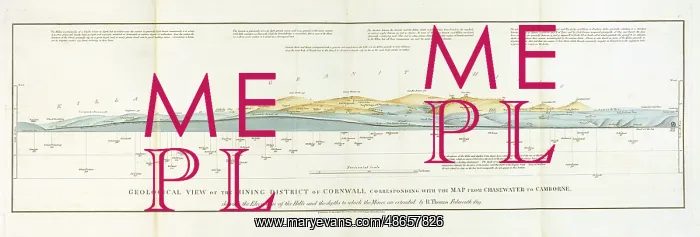
Geological View of the Mining District of Cornwall
Geological view of the mining district of Cornwall corresponding with the map from Chasewater to Cambourne shewing the elevations of the hills and the depths to which the mines are extended by R. Thomas, by Richard Thomas (1779-1858). The section originally accompanied: Thomas, Richard, Report On A Survey Of The Mining District Of Cornwall From Chasewater To Camborne (1819). Hand coloured lithograph
Picture No
14160579
Media ID
48657826
Size
4835px x 1640px
(1.4MB)
Credit
© The Geological Society / Mary Evans
Source
Geological Society of London - Image reference: 07-112
Date
1819
Pick your License
1819 Camborne Chasewater Corresponding Depths Elevations Extended Geological Mines Shewing Survey
Features In These Collections
> Contributors > GSO



















![Earliest geological map of Ireland [1814]](/sq/800/earliest-geological-map-ireland-1814-48658336.jpg.webp "Earliest geological map of Ireland [1814]")



![Draft of the first geological map of Jersey [c.1828]](/sq/800/draft-first-geological-map-jersey-c1828-48658294.jpg.webp "Draft of the first geological map of Jersey [c.1828]")
![First geological map of Jersey [c.1828]](/sq/800/first-geological-map-jersey-c1828-48658274.jpg.webp "First geological map of Jersey [c.1828]")

![First Geological Map of Scotland [1808]](/sq/800/first-geological-map-scotland-1808-48658245.jpg.webp "First Geological Map of Scotland [1808]")


