
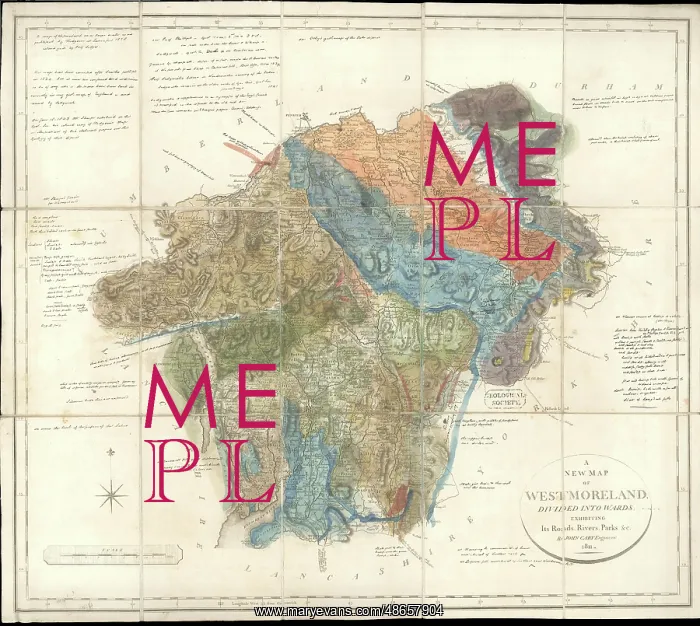
Greenough's Map of Westmoreland
Geological colouring, probably by George Bellas Greenough (1778-1855) after William Smith (1769-1839), on base map A New Map of Westmorland divided into wards, published by John Cary, 1811. Sectioned and on cloth. The map has extensive manuscript notes by Greenough in which he states that the colouring. has been corrected after Smith's published in 1824 but is now too confused and ?indistinct to be of any use - the strata has been laid in correctly in my geol. map of England and revised by [Adam] Sedgwick.. Hand colouring on engraved base map
Pick your License
1769-1839 1778-1855 1811 1824 Bellas Colouring Confused Corrected Correctly Divided Extensive Geological Greenough Greenoughs Indistinct Laid Revised Sectioned Sedgwick Strata Wards Westmoreland Westmorland
Features In These Collections
> Contributors > GSO



















![Earliest geological map of Ireland [1814]](/sq/800/earliest-geological-map-ireland-1814-48658336.jpg.webp "Earliest geological map of Ireland [1814]")



![Draft of the first geological map of Jersey [c.1828]](/sq/800/draft-first-geological-map-jersey-c1828-48658294.jpg.webp "Draft of the first geological map of Jersey [c.1828]")
![First geological map of Jersey [c.1828]](/sq/800/first-geological-map-jersey-c1828-48658274.jpg.webp "First geological map of Jersey [c.1828]")

![First Geological Map of Scotland [1808]](/sq/800/first-geological-map-scotland-1808-48658245.jpg.webp "First Geological Map of Scotland [1808]")


